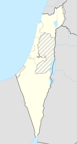
גבע כרמל
קפיצה לניווט
קפיצה לחיפוש
 | |
| מדינה | |
| מחוז | חיפה |
| מועצה אזורית | חוף הכרמל |
| גובה ממוצע[1] | 22 מטר |
| תאריך ייסוד | 1949 |
| תנועה מיישבת | תנועת המושבים |
| סוג יישוב | מושב |
| נתוני אוכלוסייה לפי הלמ"ס לסוף 2023[1] | |
| - אוכלוסייה | 1,126 תושבים |
| - מתוכם, תושבי ישראל | 1,039 תושבי ישראל |
<mapframe align="center" height="550" latitude="32.629017086307" longitude="34.949301299699" text="<div style="text-align:center;">מפת היישובים של מועצה אזורית חוף הכרמל<br />באדום - גבע כרמל<br />בירוק - מיקום בניין המועצה</div>" width="250" zoom="11">[{"properties":{"title":"geomask1","marker-color":"#0000FF"},"type":"ExternalData","service":"geomask","ids":"Q1915911"},{"features":[{"type":"Feature","geometry":{"coordinates":[34.958978867737,32.7659714932353],"type":"Point"},"properties":{"title":"כפר גלים","marker-color":"#0000FF"}},{"type":"Feature","geometry":{"coordinates":[34.956882355751,32.7522615341683],"type":"Point"},"properties":{"title":"החותרים","marker-color":"#0000FF"}},{"type":"Feature","geometry":{"coordinates":[35.0060142688368,32.7311590956266],"type":"Point"},"properties":{"title":"בית אורן","marker-color":"#0000FF"}},{"type":"Feature","geometry":{"coordinates":[34.958757997368,32.7298128568467],"type":"Point"},"properties":{"title":"מגדים","marker-color":"#0000FF"}},{"type":"Feature","geometry":{"coordinates":[34.9697724434238,32.7197349056496],"type":"Point"},"properties":{"title":"בית צבי","marker-color":"#0000FF"}},{"type":"Feature","geometry":{"coordinates":[34.9831546561293,32.7000118984182],"type":"Point"},"properties":{"title":"עין הוד","marker-color":"#0000FF"}},{"type":"Feature","geometry":{"coordinates":[34.9907276798561,32.6994840291754],"type":"Point"},"properties":{"title":"ניר עציון","marker-color":"#0000FF"}},{"type":"Feature","geometry":{"coordinates":[34.9997038608108,32.6915639866143],"type":"Point"},"properties":{"title":"עין חוד","marker-color":"#0000FF"}},{"type":"Feature","geometry":{"coordinates":[34.9426560370331,32.6910068637286],"type":"Point"},"properties":{"title":"עתלית","marker-color":"#0000FF"}},{"type":"Feature","geometry":{"coordinates":[34.9306417391041,32.6794392966622],"type":"Point"},"properties":{"title":"נווה ים","marker-color":"#0000FF"}},{"type":"Feature","geometry":{"coordinates":[34.9532518583476,32.6770520635679],"type":"Point"},"properties":{"title":"עין כרמל","marker-color":"#0000FF"}},{"type":"Feature","geometry":{"coordinates":[34.957826,32.676298],"type":"Point"},"properties":{"title":"בניין מועצה אזורית חוף הכרמל","marker-color":"#00FF00"}},{"type":"Feature","geometry":{"coordinates":[34.954677775509,32.6627176955579],"type":"Point"},"properties":{"title":"גבע כרמל","marker-color":"#FF0000"}},{"type":"Feature","geometry":{"coordinates":[34.9483221827055,32.64854795735],"type":"Point"},"properties":{"title":"צרופה","marker-color":"#0000FF"}},{"type":"Feature","geometry":{"coordinates":[34.9905348183576,32.646192493399],"type":"Point"},"properties":{"title":"כרם מהר\"ל","marker-color":"#0000FF"}},{"type":"Feature","geometry":{"coordinates":[34.9326889038371,32.6371534192029],"type":"Point"},"properties":{"title":"הבונים","marker-color":"#0000FF"}},{"type":"Feature","geometry":{"coordinates":[34.946352540404,32.6292471910528],"type":"Point"},"properties":{"title":"עין אילה","marker-color":"#0000FF"}},{"type":"Feature","geometry":{"coordinates":[34.9820675364369,32.6222822317771],"type":"Point"},"properties":{"title":"עופר","marker-color":"#0000FF"}},{"type":"Feature","geometry":{"coordinates":[34.9207208852807,32.6135920783485],"type":"Point"},"properties":{"title":"נחשולים","marker-color":"#0000FF"}},{"type":"Feature","geometry":{"coordinates":[34.9209524382724,32.6077314261302],"type":"Point"},"properties":{"title":"דור","marker-color":"#0000FF"}},{"type":"Feature","geometry":{"coordinates":[35.0035334235826,32.6004066379624],"type":"Point"},"properties":{"title":"בת שלמה","marker-color":"#0000FF"}},{"type":"Feature","geometry":{"coordinates":[34.9713857062127,32.5914239546702],"type":"Point"},"properties":{"title":"מאיר שפיה","marker-color":"#0000FF"}},{"type":"Feature","geometry":{"coordinates":[34.9405642420044,32.5681885791085],"type":"Point"},"properties":{"title":"מעיין צבי","marker-color":"#0000FF"}},{"type":"Feature","geometry":{"coordinates":[34.9160040429855,32.5561415666024],"type":"Point"},"properties":{"title":"מעגן מיכאל","marker-color":"#0000FF"}},{"type":"Feature","geometry":{"coordinates":[34.9258856342825,32.5283004512806],"type":"Point"},"properties":{"title":"בית חנניה","marker-color":"#0000FF"}},{"type":"Feature","geometry":{"coordinates":[34.9077525245928,32.5075190711756],"type":"Point"},"properties":{"title":"קיסריה","marker-color":"#0000FF"}},{"type":"Feature","geometry":{"coordinates":[34.892588330561,32.4920626793793],"type":"Point"},"properties":{"title":"שדות ים","marker-color":"#0000FF"}}],"type":"FeatureCollection"}]</mapframe>
| |
| מדד חברתי-כלכלי - אשכול לשנת 2021[2] |
8 מתוך 10 |
גֶּבַע כַּרְמֶל הוא מושב באזור הצפון ליד עתלית השייך למועצה אזורית חוף הכרמל.
היישוב הוקם בי"ט באב תש"ט, 17 באוגוסט 1949, על ידי עולים מתוניסיה וטורקיה.[3] תחילה נקרא בשם "גבע הכרמל", בו השתמשו עד שנות ה-70.
שמו של היישוב נובע משמו של היישוב הערבי שהיה ממוקם בסמוך, "ג'בע". מקומה של ג'בע נזכרת בכתבי ההיסטוריון הרומאי פליניוס הזקן במאה הראשונה לסה"נ, ובכתב אוסביוס, שחי במאה הרביעית בקיסריה הסמוכה.[4] בשנת 1953 בסמוך למושב הוקם יער אטאטורק.
נכון ל-2023 מונה אוכלוסיית המושב כ-1,126 תושבים. רבים מהם ממשפחות ותיקי המושב. במושב יש 80 נחלות חקלאיות והרחבה שרובה מאוכלסת.[3] פרנסת התושבים מבוססת על חקלאות (בעיקר גידול בננות וירקות) ועל עבודה מחוץ למושב, כולל במקצועות חופשיים.[3]
קישורים חיצוניים
 אתר האינטרנט הרשמי של גבע כרמל

הערות שוליים
- ^ 1 2 אוכלוסייה בעיריות, במועצות המקומיות והאזוריות וביישובים בעלי 2,000 תושבים לפחות - לפי טבלה חודשית של למ"ס עבור סוף דצמבר 2024 (אומדן), בכל יתר היישובים - לפי טבלה שנתית של למ"ס עבור סוף 2023.
- ^ הנתונים לפי טבלת מדד חברתי כלכלי של למ"ס נכון לשנת 2021
- ^ 1 2 3 אתר המושב גבע כרמל
- ^ זאב וילנאי, "אנציקלופדיה לידיעת הארץ", הוצאת ידיעות אחרונות, תשט"ז, 1956, כרך א', עמודים 180–181
| ||||||||||||||||||


