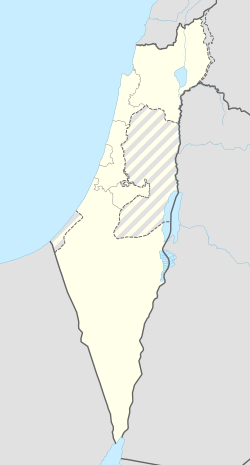
חגור
| מדינה | |
| מחוז | המרכז |
| מועצה אזורית | דרום השרון |
| גובה ממוצע[1] | 34 מטר |
| תאריך ייסוד | 1949 |
| תנועה מיישבת | תנועת המושבים |
| סוג יישוב | מושב |
| נתוני אוכלוסייה לפי הלמ"ס לסוף 2023[1] | |
| - אוכלוסייה | 1,126 תושבים |
| - מתוכם, תושבי ישראל | 1,110 תושבי ישראל |
<mapframe align="center" height="450" latitude="32.14" longitude="34.944033842352" text="<div style="text-align:center;">מפת היישובים של מועצה אזורית דרום השרון<br />באדום - חגור<br />בירוק - מיקום בניין המועצה</div>" width="250" zoom="11">[{"properties":{"title":"geomask1","marker-color":"#0000FF"},"type":"ExternalData","service":"geomask","ids":"Q2249100"},{"features":[{"type":"Feature","geometry":{"coordinates":[34.9987050651781,32.241051897359],"type":"Point"},"properties":{"title":"צור יצחק","marker-color":"#0000FF"}},{"type":"Feature","geometry":{"coordinates":[35.0132419671433,32.2408042379203],"type":"Point"},"properties":{"title":"צור נתן","marker-color":"#0000FF"}},{"type":"Feature","geometry":{"coordinates":[34.9381876403966,32.217582718432],"type":"Point"},"properties":{"title":"רמת הכובש","marker-color":"#0000FF"}},{"type":"Feature","geometry":{"coordinates":[34.9791480666128,32.2117107587434],"type":"Point"},"properties":{"title":"אייל","marker-color":"#0000FF"}},{"type":"Feature","geometry":{"coordinates":[34.9032153541346,32.207494378055],"type":"Point"},"properties":{"title":"שדה ורבורג","marker-color":"#0000FF"}},{"type":"Feature","geometry":{"coordinates":[34.9262509408958,32.201144628835],"type":"Point"},"properties":{"title":"בית ברל","marker-color":"#0000FF"}},{"type":"Feature","geometry":{"coordinates":[34.9489581473265,32.1973149785298],"type":"Point"},"properties":{"title":"ניר אליהו","marker-color":"#0000FF"}},{"type":"Feature","geometry":{"coordinates":[34.9058015755577,32.1950559952199],"type":"Point"},"properties":{"title":"גן חיים","marker-color":"#0000FF"}},{"type":"Feature","geometry":{"coordinates":[34.9206548041062,32.1931063432705],"type":"Point"},"properties":{"title":"צופית","marker-color":"#0000FF"}},{"type":"Feature","geometry":{"coordinates":[34.9398066666815,32.1713248336374],"type":"Point"},"properties":{"title":"נווה ימין","marker-color":"#0000FF"}},{"type":"Feature","geometry":{"coordinates":[34.8748257175597,32.1681059069764],"type":"Point"},"properties":{"title":"גבעת ח\"ן","marker-color":"#0000FF"}},{"type":"Feature","geometry":{"coordinates":[34.8941214794198,32.1680646098948],"type":"Point"},"properties":{"title":"כפר מל\"ל","marker-color":"#0000FF"}},{"type":"Feature","geometry":{"coordinates":[34.8831037420128,32.1656924283403],"type":"Point"},"properties":{"title":"רמות השבים","marker-color":"#0000FF"}},{"type":"Feature","geometry":{"coordinates":[34.9432326141218,32.1596989551868],"type":"Point"},"properties":{"title":"שדי חמד","marker-color":"#0000FF"}},{"type":"Feature","geometry":{"coordinates":[34.9729185889783,32.1584943545936],"type":"Point"},"properties":{"title":"מתן","marker-color":"#0000FF"}},{"type":"Feature","geometry":{"coordinates":[34.9678448586432,32.1528037019048],"type":"Point"},"properties":{"title":"ירחיב","marker-color":"#0000FF"}},{"type":"Feature","geometry":{"coordinates":[34.92851819358,32.1527239294589],"type":"Point"},"properties":{"title":"אלישמע","marker-color":"#0000FF"}},{"type":"Feature","geometry":{"coordinates":[34.9013863074664,32.1513090827644],"type":"Point"},"properties":{"title":"גני עם","marker-color":"#0000FF"}},{"type":"Feature","geometry":{"coordinates":[34.9850314568152,32.1468829255767],"type":"Point"},"properties":{"title":"נירית","marker-color":"#0000FF"}},{"type":"Feature","geometry":{"coordinates":[34.8974845708351,32.1452577061875],"type":"Point"},"properties":{"title":"ירקונה","marker-color":"#0000FF"}},{"type":"Feature","geometry":{"coordinates":[34.9052391215672,32.140045949392],"type":"Point"},"properties":{"title":"עדנים","marker-color":"#0000FF"}},{"type":"Feature","geometry":{"coordinates":[34.9711695103978,32.137659854816],"type":"Point"},"properties":{"title":"חורשים","marker-color":"#0000FF"}},{"type":"Feature","geometry":{"coordinates":[34.9470055782949,32.1374325790708],"type":"Point"},"properties":{"title":"חגור","marker-color":"#FF0000"}},{"type":"Feature","geometry":{"coordinates":[34.911086,32.133649],"type":"Point"},"properties":{"title":"בניין מועצה אזורית דרום השרון","marker-color":"#00FF00"}},{"type":"Feature","geometry":{"coordinates":[34.9244447811114,32.1328756665227],"type":"Point"},"properties":{"title":"נווה ירק","marker-color":"#0000FF"}},{"type":"Feature","geometry":{"coordinates":[34.9213737308309,32.0977891862478],"type":"Point"},"properties":{"title":"גבעת השלושה","marker-color":"#0000FF"}},{"type":"Feature","geometry":{"coordinates":[34.9385788084808,32.0829469237996],"type":"Point"},"properties":{"title":"עינת","marker-color":"#0000FF"}},{"type":"Feature","geometry":{"coordinates":[34.9244021748078,32.0774153791522],"type":"Point"},"properties":{"title":"כפר סירקין","marker-color":"#0000FF"}},{"type":"Feature","geometry":{"coordinates":[34.8800553043082,32.068471843147],"type":"Point"},"properties":{"title":"גת רימון","marker-color":"#0000FF"}},{"type":"Feature","geometry":{"coordinates":[34.8895999407237,32.0646182322341],"type":"Point"},"properties":{"title":"מעש","marker-color":"#0000FF"}},{"type":"Feature","geometry":{"coordinates":[34.9489136237666,32.0612349114036],"type":"Point"},"properties":{"title":"נחשונים","marker-color":"#0000FF"}},{"type":"Feature","geometry":{"coordinates":[34.8990852215193,32.0465153414728],"type":"Point"},"properties":{"title":"מגשימים","marker-color":"#0000FF"}}],"type":"FeatureCollection"}]</mapframe>
| |
| מדד חברתי-כלכלי - אשכול לשנת 2021[2] |
8 מתוך 10 |
חֲגוֹר הוא מושב במועצה אזורית דרום השרון, השוכן בין ראש העין לכפר סבא. המושב נוסד בשנת 1949 כמושב שיתופי על ידי יוצאי גדוד 9 של הפלמ"ח, ועולים חדשים, בייחוד מבולגריה ואיראן. בעבר תחום העיסוק המרכזי היה חקלאות.
במושב ישנו מועדון נוער, מועדון חוגים, בית עם, בית כנסת, צרכנייה, גן ילדים, קופת חולים, ספרייה, בריכת שחייה ומגרשי טניס. ילדי המושב לומדים במספר בתי ספר שונים באזור השרון ("מתן", "צופית" שעבר לבית ברל). תלמידי חטיבת הביניים ותלמידי התיכון לומדים בבית חינוך ירקון שנמצא ליד מושב נווה ירק במתחם המועצה האזורית דרום השרון. במושב הוקם מרכז מיחזור לצורך הגברת המודעות לשמירה על איכות הסביבה בקרב הילדים והנוער.
ממושב זה יצאו קצינים רבים, הבולטים שבהם הם שני הרמטכ"לים לשעבר, גבי אשכנזי ודני חלוץ.
מקור השם
בשנת 1954 קבעה ועדת השמות הממשלתית את השם חגור למושב[3]. מקור השם בפסוק ”חֲגוֹר חַרְבְּךָ עַל יָרֵךְ גִּבּוֹר הוֹדְךָ וַהֲדָרֶךָ” (תהילים, מ"ה, ד').
היסטוריה
הגרעין המייסד של המושב כלל יוצאי בולגריה, אנשי גח"ל, שקבלו הכשרה בנהלל[4]. המושב נוסד בנובמבר 1949[5]. הקמת המושב תוארה במאי 1951[6]:
- "לחבל ארץ זה הגיעו 7 בחורים משוחררי צה"ל אשר הוקסמו מנוף המקום. ...הציבו מספר אהלים צבאיים ויקראו למקום גדוד 9, בו שרתו במלחמת השחרור. חלוצים אלה ברובם יוצאי ארצות הבלקן עמדו בעקשנותם ובהעמידם את המוסדות בפני עובדה קיימת הצליחו להשיג מהמוסדות את שלשת הצריפים הראשונים - הגרעין לנקודה החדשה. ... שלשת אלפים דונם העמדו לרשותם. אולם היד העובדת חסרה. ... הצליח להתגבש במקום גרעין של עשרות צעירים וצעירות אשר הפכו תוך תקופה קצרה למשפחות".
במסגרת תנועת מן העיר אל הכפר פעלה תנועת המושבים בסוף 1952 להביא למושב 30 משפחות נוספות[7].
קישורים חיצוניים
- חגור באתר מועצה אזורית דרום השרון
 חגור (ישראל), דף שער בספרייה הלאומית
הערות שוליים
- ^ 1 2 אוכלוסייה בעיריות, במועצות המקומיות והאזוריות וביישובים בעלי 2,000 תושבים לפחות - לפי טבלה חודשית של למ"ס עבור סוף דצמבר 2024 (אומדן), בכל יתר היישובים - לפי טבלה שנתית של למ"ס עבור סוף 2023.
- ^ הנתונים לפי טבלת מדד חברתי כלכלי של למ"ס נכון לשנת 2021
- ^ שמות נכונים ליישובים, חרות, 5 במאי 1954
- ^ ש. אנגל, חגור לרגלי הרי אפרים, דבר, 7 במאי 1954
- ^ 14 ישובים חדשים, העולם, 15 בדצמבר 1949
- ^ ברוך וויניצקי, ההתיישבות אשר על הגבול, חרות, 18 במאי 1951; המשך
- ^ נתן דונביץ, חמישה חצים אל הכפר, הארץ, 24 באוקטובר 1952
| ||||||||||||||


