ראס אל-עין (הגליל)
 תצלום מהר כמון על הכפר למרגלותיו תצלום מהר כמון על הכפר למרגלותיו
| |
| שם בערבית | راس العين |
| מדינה | |
| מחוז | הצפון |
| מועצה אזורית | משגב |
| גובה ממוצע[1] | 221 מטר |
| סוג יישוב | יישוב כפרי אחר |
| נתוני אוכלוסייה לפי הלמ"ס לסוף 2023[1] | |
| - אוכלוסייה | 452 תושבים |
| - מתוכם, תושבי ישראל | 452 תושבי ישראל |
<mapframe align="center" height="360" latitude="32.886015410783" longitude="35.286173333673" text="<div style="text-align:center;">מפת היישובים של מועצה אזורית משגב<br />באדום - ראס אל-עין<br />בירוק - מיקום בניין המועצה</div>" width="400" zoom="11">[{"properties":{"title":"geomask1","marker-color":"#0000FF"},"type":"ExternalData","service":"geomask","ids":"Q1965822"},{"features":[{"type":"Feature","geometry":{"coordinates":[35.3279720152292,32.9566779959262],"type":"Point"},"properties":{"title":"חרשים","marker-color":"#0000FF"}},{"type":"Feature","geometry":{"coordinates":[35.3121357055603,32.950561280935],"type":"Point"},"properties":{"title":"הר חלוץ","marker-color":"#0000FF"}},{"type":"Feature","geometry":{"coordinates":[35.2499985533161,32.9460910325966],"type":"Point"},"properties":{"title":"כישור","marker-color":"#0000FF"}},{"type":"Feature","geometry":{"coordinates":[35.2861398837339,32.9415642446998],"type":"Point"},"properties":{"title":"לבון","marker-color":"#0000FF"}},{"type":"Feature","geometry":{"coordinates":[35.2335258931061,32.9338331494336],"type":"Point"},"properties":{"title":"פלך","marker-color":"#0000FF"}},{"type":"Feature","geometry":{"coordinates":[35.2453925715432,32.9295919416181],"type":"Point"},"properties":{"title":"תובל","marker-color":"#0000FF"}},{"type":"Feature","geometry":{"coordinates":[35.1781410680167,32.9267104776227],"type":"Point"},"properties":{"title":"טל-אל","marker-color":"#0000FF"}},{"type":"Feature","geometry":{"coordinates":[35.39420559933,32.9207983756953],"type":"Point"},"properties":{"title":"מורן","marker-color":"#0000FF"}},{"type":"Feature","geometry":{"coordinates":[35.3724909283039,32.9143374059095],"type":"Point"},"properties":{"title":"ראס אל-עין","marker-color":"#FF0000"}},{"type":"Feature","geometry":{"coordinates":[35.3507882940311,32.9132827093248],"type":"Point"},"properties":{"title":"כמאנה","marker-color":"#0000FF"}},{"type":"Feature","geometry":{"coordinates":[35.3588005957545,32.9102975216934],"type":"Point"},"properties":{"title":"כמון","marker-color":"#0000FF"}},{"type":"Feature","geometry":{"coordinates":[35.3277956325644,32.9066351023368],"type":"Point"},"properties":{"title":"מכמנים","marker-color":"#0000FF"}},{"type":"Feature","geometry":{"coordinates":[35.2367224928802,32.9030850904971],"type":"Point"},"properties":{"title":"גילון","marker-color":"#0000FF"}},{"type":"Feature","geometry":{"coordinates":[35.2529692114447,32.9027191697223],"type":"Point"},"properties":{"title":"צורית","marker-color":"#0000FF"}},{"type":"Feature","geometry":{"coordinates":[35.319557512685,32.9008722069816],"type":"Point"},"properties":{"title":"חוסנייה","marker-color":"#0000FF"}},{"type":"Feature","geometry":{"coordinates":[35.2588420045536,32.8928884132601],"type":"Point"},"properties":{"title":"שורשים","marker-color":"#0000FF"}},{"type":"Feature","geometry":{"coordinates":[35.3684957151008,32.8927023910883],"type":"Point"},"properties":{"title":"סלאמה","marker-color":"#0000FF"}},{"type":"Feature","geometry":{"coordinates":[35.3316196472737,32.8897698201003],"type":"Point"},"properties":{"title":"מעלה צביה","marker-color":"#0000FF"}},{"type":"Feature","geometry":{"coordinates":[35.2898314318528,32.8882725006274],"type":"Point"},"properties":{"title":"ערב אל נעים","marker-color":"#0000FF"}},{"type":"Feature","geometry":{"coordinates":[35.3001951766531,32.8858304441206],"type":"Point"},"properties":{"title":"אשחר","marker-color":"#0000FF"}},{"type":"Feature","geometry":{"coordinates":[35.3582176804159,32.8822559450954],"type":"Point"},"properties":{"title":"לוטם","marker-color":"#0000FF"}},{"type":"Feature","geometry":{"coordinates":[35.2431252280708,32.8788279867788],"type":"Point"},"properties":{"title":"יעד","marker-color":"#0000FF"}},{"type":"Feature","geometry":{"coordinates":[35.2704809923007,32.8788165345455],"type":"Point"},"properties":{"title":"יובלים","marker-color":"#0000FF"}},{"type":"Feature","geometry":{"coordinates":[35.3053144718599,32.8767194038435],"type":"Point"},"properties":{"title":"אשבל","marker-color":"#0000FF"}},{"type":"Feature","geometry":{"coordinates":[35.2520945009375,32.8660209480684],"type":"Point"},"properties":{"title":"עצמון-שגב","marker-color":"#0000FF"}},{"type":"Feature","geometry":{"coordinates":[35.261095,32.858925],"type":"Point"},"properties":{"title":"בניין מועצה אזורית משגב","marker-color":"#00FF00"}},{"type":"Feature","geometry":{"coordinates":[35.2642674194188,32.8552856336254],"type":"Point"},"properties":{"title":"רקפת","marker-color":"#0000FF"}},{"type":"Feature","geometry":{"coordinates":[35.2364909084852,32.853492451776],"type":"Point"},"properties":{"title":"מנוף","marker-color":"#0000FF"}},{"type":"Feature","geometry":{"coordinates":[35.2469577874398,32.8487103815429],"type":"Point"},"properties":{"title":"שכניה","marker-color":"#0000FF"}},{"type":"Feature","geometry":{"coordinates":[35.3671276172088,32.845816546035],"type":"Point"},"properties":{"title":"הררית","marker-color":"#0000FF"}},{"type":"Feature","geometry":{"coordinates":[35.252189624597,32.8441098762435],"type":"Point"},"properties":{"title":"קורנית","marker-color":"#0000FF"}},{"type":"Feature","geometry":{"coordinates":[35.2718384755365,32.8368873100991],"type":"Point"},"properties":{"title":"יודפת","marker-color":"#0000FF"}},{"type":"Feature","geometry":{"coordinates":[35.2003837755566,32.8368152043796],"type":"Point"},"properties":{"title":"מצפה אבי\"ב","marker-color":"#0000FF"}},{"type":"Feature","geometry":{"coordinates":[35.3506621931555,32.8364593160365],"type":"Point"},"properties":{"title":"אבטליון","marker-color":"#0000FF"}},{"type":"Feature","geometry":{"coordinates":[35.2941591087562,32.8346190654264],"type":"Point"},"properties":{"title":"חוג'ייראת (ד'הרה) (שבט)","marker-color":"#0000FF"}},{"type":"Feature","geometry":{"coordinates":[35.2334909034297,32.8263522851131],"type":"Point"},"properties":{"title":"מורשת","marker-color":"#0000FF"}},{"type":"Feature","geometry":{"coordinates":[35.2277210802756,32.8153528256395],"type":"Point"},"properties":{"title":"דמיידה","marker-color":"#0000FF"}}],"type":"FeatureCollection"}]</mapframe>
| |
| מדד חברתי-כלכלי - אשכול לשנת 2021[2] |
3 מתוך 10 |
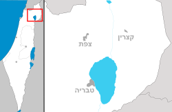
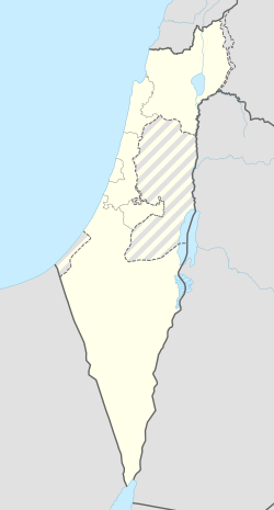
ראס אל-עין (בערבית: راس العين) הוא כפר בדואי־ערבי בגליל במחוז הצפון שבישראל, ממערב לעיר כרמיאל, בתחומי המועצה האזורית משגב. הכפר הוכר ב־1996 על-די הרשויות. פירוש שמו בשפה הערבית הוא "ראש המעיין". רוב תושבי הכפר הם בדואים־מוסלמים (כ־56%), בני חמולת סֻעָאד (سعاد); לצד מיעוט משמעותי של הם ערבים־נוצרים (כ־44%), נצר לשושלת ניקולא (نيقولا).[דרוש מקור] על־פי הלמ"ס, נכון לסוף 2022, התגוררו בכפר זה 412 תושבים.
כיום ממוקם הכפר על כביש 804, כשהיישוב הקהילתי כמון נמצא כקילומטר ממערב, פר ראמה נמצא כשני ק"מ מצפון, וכפר סלאמה נמצא כ־2.5 ק"מ מדרום.[3]
גאוגרפיה

הכפר ממוקם בגליל העליון, בגובה של כ־221 מטרים מעל פני הים.
סמוך לכפר מצוי נחל צלמון, ובו מסלול טיולים העובר בין עצים עתיקים, טחנות עתיקות ואגני מים זורמים. קרן קיימת לישראל בשיתוף עם המועצה האזורית משגב, יזמו פעילויות חינוכיות ואקולוגיות לילדי הכפר, למען טיפוח שבילים בשמורות הטבע השוכנות למרגלותיו של הר כמון.
ראו גם
- ערביי ארץ ישראל
- הגליל
- ערביי ישראל
- מועצה אזורית משגב
- נפת עכו במחוז הצפון (שבמדינת ישראל)
קישורים חיצוניים
הערות שוליים
- ^ 1 2 אוכלוסייה בעיריות, במועצות המקומיות והאזוריות וביישובים בעלי 2,000 תושבים לפחות - לפי טבלה חודשית של למ"ס עבור סוף דצמבר 2024 (אומדן), בכל יתר היישובים - לפי טבלה שנתית של למ"ס עבור סוף 2023.
- ^ הנתונים לפי טבלת מדד חברתי כלכלי של למ"ס נכון לשנת 2021
- ^ Mark Tessler, Arabs in Israel (1980), Cham: Springer International Publishing, 2019-07-20, עמ' 345–390, ISBN 978-3-030-19842-8
| ||||||||||||||||


