גיזו
 | |
| מדינה | |
| מחוז | ירושלים |
| מועצה אזורית | מטה יהודה |
| גובה ממוצע[1] | 196 מטר |
| תאריך ייסוד | 1960 |
| סוג יישוב | יישוב כפרי אחר |
| נתוני אוכלוסייה לפי הלמ"ס לסוף 2023[1] | |
| - אוכלוסייה | 212 תושבים |
| - מתוכם, תושבי ישראל | 212 תושבי ישראל |
<mapframe align="center" height="480" latitude="31.73" longitude="35.05" text="<div style="text-align:center;">מפת היישובים של מועצה אזורית מטה יהודה<br />באדום - גיזו<br />בירוק - מיקום בניין המועצה</div>" width="560" zoom="11">[{"properties":{"title":"geomask1","marker-color":"#0000FF"},"type":"ExternalData","service":"geomask","ids":"Q799284"},{"features":[{"type":"Feature","geometry":{"coordinates":[35.0676465923132,31.831996523923],"type":"Point"},"properties":{"marker-size":"small","title":"נטף","marker-color":"#0000FF"}},{"type":"Feature","geometry":{"coordinates":[34.9556763879237,31.8311952910857],"type":"Point"},"properties":{"marker-size":"small","title":"נחשון","marker-color":"#0000FF"}},{"type":"Feature","geometry":{"coordinates":[34.925683807344,31.8287882530478],"type":"Point"},"properties":{"marker-size":"small","title":"בקוע","marker-color":"#0000FF"}},{"type":"Feature","geometry":{"coordinates":[34.9785260223232,31.8177104860201],"type":"Point"},"properties":{"marker-size":"small","title":"נווה שלום","marker-color":"#0000FF"}},{"type":"Feature","geometry":{"coordinates":[35.1108655293526,31.8176965390773],"type":"Point"},"properties":{"marker-size":"small","title":"מעלה החמישה","marker-color":"#0000FF"}},{"type":"Feature","geometry":{"coordinates":[35.1055892371023,31.8133637233424],"type":"Point"},"properties":{"marker-size":"small","title":"ידידה","marker-color":"#0000FF"}},{"type":"Feature","geometry":{"coordinates":[35.1042181172241,31.8116491574271],"type":"Point"},"properties":{"marker-size":"small","title":"כפר הנוער קריית יערים","marker-color":"#0000FF"}},{"type":"Feature","geometry":{"coordinates":[35.1197440454182,31.8104880714421],"type":"Point"},"properties":{"marker-size":"small","title":"קריית ענבים","marker-color":"#0000FF"}},{"type":"Feature","geometry":{"coordinates":[35.0896460020013,31.8098331480275],"type":"Point"},"properties":{"marker-size":"small","title":"יד השמונה","marker-color":"#0000FF"}},{"type":"Feature","geometry":{"coordinates":[34.9495047953107,31.8090881446983],"type":"Point"},"properties":{"marker-size":"small","title":"הראל","marker-color":"#0000FF"}},{"type":"Feature","geometry":{"coordinates":[35.081305276587,31.8080216612364],"type":"Point"},"properties":{"marker-size":"small","title":"נווה אילן","marker-color":"#0000FF"}},{"type":"Feature","geometry":{"coordinates":[34.9026278172536,31.8051075720472],"type":"Point"},"properties":{"marker-size":"small","title":"טל שחר","marker-color":"#0000FF"}},{"type":"Feature","geometry":{"coordinates":[34.9389559238356,31.8049181045212],"type":"Point"},"properties":{"marker-size":"small","title":"גיזו","marker-color":"#FF0000"}},{"type":"Feature","geometry":{"coordinates":[34.9312479980794,31.8045410346457],"type":"Point"},"properties":{"marker-size":"small","title":"צלפון","marker-color":"#0000FF"}},{"type":"Feature","geometry":{"coordinates":[35.1259800699809,31.8045399435034],"type":"Point"},"properties":{"marker-size":"small","title":"בית נקופה","marker-color":"#0000FF"}},{"type":"Feature","geometry":{"coordinates":[35.0111939894389,31.8023429777083],"type":"Point"},"properties":{"marker-size":"small","title":"מסילת ציון","marker-color":"#0000FF"}},{"type":"Feature","geometry":{"coordinates":[34.9746594932368,31.8010195980549],"type":"Point"},"properties":{"marker-size":"small","title":"תעוז","marker-color":"#0000FF"}},{"type":"Feature","geometry":{"coordinates":[35.0780447265119,31.7982786031418],"type":"Point"},"properties":{"marker-size":"small","title":"שואבה","marker-color":"#0000FF"}},{"type":"Feature","geometry":{"coordinates":[35.0653748392207,31.7971831610626],"type":"Point"},"properties":{"marker-size":"small","title":"שורש","marker-color":"#0000FF"}},{"type":"Feature","geometry":{"coordinates":[35.0367642537881,31.7940823776834],"type":"Point"},"properties":{"marker-size":"small","title":"בית מאיר","marker-color":"#0000FF"}},{"type":"Feature","geometry":{"coordinates":[35.1576664639112,31.7938236757914],"type":"Point"},"properties":{"marker-size":"small","title":"מוצא עילית","marker-color":"#0000FF"}},{"type":"Feature","geometry":{"coordinates":[34.9465916293051,31.7933001429528],"type":"Point"},"properties":{"marker-size":"small","title":"כפר אוריה","marker-color":"#0000FF"}},{"type":"Feature","geometry":{"coordinates":[35.1198653605666,31.7932630230601],"type":"Point"},"properties":{"marker-size":"small","title":"עין נקובא","marker-color":"#0000FF"}},{"type":"Feature","geometry":{"coordinates":[35.115011071178,31.7902836244628],"type":"Point"},"properties":{"marker-size":"small","title":"עין ראפה","marker-color":"#0000FF"}},{"type":"Feature","geometry":{"coordinates":[35.091997161122,31.7869285307505],"type":"Point"},"properties":{"marker-size":"small","title":"גבעת יערים","marker-color":"#0000FF"}},{"type":"Feature","geometry":{"coordinates":[35.1194519177937,31.7835228628547],"type":"Point"},"properties":{"marker-size":"small","title":"צובה","marker-color":"#0000FF"}},{"type":"Feature","geometry":{"coordinates":[34.9817778473593,31.782995509285],"type":"Point"},"properties":{"marker-size":"small","title":"תרום","marker-color":"#0000FF"}},{"type":"Feature","geometry":{"coordinates":[35.1617899091645,31.7821011884514],"type":"Point"},"properties":{"marker-size":"small","title":"בית זית","marker-color":"#0000FF"}},{"type":"Feature","geometry":{"coordinates":[35.009126569642,31.7811466064154],"type":"Point"},"properties":{"marker-size":"small","title":"אשתאול","marker-color":"#0000FF"}},{"type":"Feature","geometry":{"coordinates":[35.095279567314,31.7789951866804],"type":"Point"},"properties":{"marker-size":"small","title":"בית חולים איתנים","marker-color":"#0000FF"}},{"type":"Feature","geometry":{"coordinates":[35.1530291025659,31.7782200200254],"type":"Point"},"properties":{"marker-size":"small","title":"בית ספר אזורי עין כרם","marker-color":"#0000FF"}},{"type":"Feature","geometry":{"coordinates":[34.9471660414334,31.7765271205505],"type":"Point"},"properties":{"marker-size":"small","title":"דיר ראפאת","marker-color":"#0000FF"}},{"type":"Feature","geometry":{"coordinates":[34.9517099853645,31.7749129230047],"type":"Point"},"properties":{"marker-size":"small","title":"גבעת שמש","marker-color":"#0000FF"}},{"type":"Feature","geometry":{"coordinates":[35.0493630192319,31.7740775125737],"type":"Point"},"properties":{"marker-size":"small","title":"כסלון","marker-color":"#0000FF"}},{"type":"Feature","geometry":{"coordinates":[35.0732218553574,31.7738338269269],"type":"Point"},"properties":{"marker-size":"small","title":"רמת רזיאל","marker-color":"#0000FF"}},{"type":"Feature","geometry":{"coordinates":[35.0034572593471,31.7664377588314],"type":"Point"},"properties":{"marker-size":"small","title":"נחם","marker-color":"#0000FF"}},{"type":"Feature","geometry":{"coordinates":[34.999254,31.764413],"type":"Point"},"properties":{"marker-size":"small","title":"בניין מועצה אזורית מטה יהודה","marker-color":"#00FF00"}},{"type":"Feature","geometry":{"coordinates":[34.9691591871385,31.7629519256861],"type":"Point"},"properties":{"marker-size":"small","title":"צרעה","marker-color":"#0000FF"}},{"type":"Feature","geometry":{"coordinates":[35.134670861365,31.7628799178354],"type":"Point"},"properties":{"marker-size":"small","title":"אבן ספיר","marker-color":"#0000FF"}},{"type":"Feature","geometry":{"coordinates":[35.1529369884034,31.7539603633985],"type":"Point"},"properties":{"marker-size":"small","title":"אורה","marker-color":"#0000FF"}},{"type":"Feature","geometry":{"coordinates":[35.1416451719615,31.7516104839557],"type":"Point"},"properties":{"marker-size":"small","title":"עמינדב","marker-color":"#0000FF"}},{"type":"Feature","geometry":{"coordinates":[34.9655995012156,31.7515820750631],"type":"Point"},"properties":{"marker-size":"small","title":"ישעי","marker-color":"#0000FF"}},{"type":"Feature","geometry":{"coordinates":[34.8860231397608,31.7507764795177],"type":"Point"},"properties":{"marker-size":"small","title":"תירוש","marker-color":"#0000FF"}},{"type":"Feature","geometry":{"coordinates":[35.0072967920365,31.7478657914362],"type":"Point"},"properties":{"marker-size":"small","title":"מחסיה","marker-color":"#0000FF"}},{"type":"Feature","geometry":{"coordinates":[35.0583816793908,31.7452291757573],"type":"Point"},"properties":{"marker-size":"small","title":"נס הרים","marker-color":"#0000FF"}},{"type":"Feature","geometry":{"coordinates":[34.8785648255164,31.7407471563755],"type":"Point"},"properties":{"marker-size":"small","title":"גפן","marker-color":"#0000FF"}},{"type":"Feature","geometry":{"coordinates":[35.2183733116408,31.7398110594845],"type":"Point"},"properties":{"marker-size":"small","title":"רמת רחל","marker-color":"#0000FF"}},{"type":"Feature","geometry":{"coordinates":[34.9992041653401,31.7325216125401],"type":"Point"},"properties":{"marker-size":"small","title":"זנוח","marker-color":"#0000FF"}},{"type":"Feature","geometry":{"coordinates":[35.0724398041795,31.7298229476091],"type":"Point"},"properties":{"marker-size":"small","title":"בר גיורא","marker-color":"#0000FF"}},{"type":"Feature","geometry":{"coordinates":[35.1058976031625,31.721826803964],"type":"Point"},"properties":{"marker-size":"small","title":"מבוא ביתר","marker-color":"#0000FF"}},{"type":"Feature","geometry":{"coordinates":[34.9205199814769,31.721187485243],"type":"Point"},"properties":{"marker-size":"small","title":"שדות מיכה","marker-color":"#0000FF"}},{"type":"Feature","geometry":{"coordinates":[35.0621170868133,31.7179975896608],"type":"Point"},"properties":{"marker-size":"small","title":"מטע","marker-color":"#0000FF"}},{"type":"Feature","geometry":{"coordinates":[34.9449243908007,31.7096959376404],"type":"Point"},"properties":{"marker-size":"small","title":"זכריה","marker-color":"#0000FF"}},{"type":"Feature","geometry":{"coordinates":[34.9122584470188,31.6977207528911],"type":"Point"},"properties":{"marker-size":"small","title":"עגור","marker-color":"#0000FF"}},{"type":"Feature","geometry":{"coordinates":[34.9825322978636,31.6880324423825],"type":"Point"},"properties":{"marker-size":"small","title":"נתיב הל\"ה","marker-color":"#0000FF"}},{"type":"Feature","geometry":{"coordinates":[34.8866650863877,31.6863863375325],"type":"Point"},"properties":{"marker-size":"small","title":"לוזית","marker-color":"#0000FF"}},{"type":"Feature","geometry":{"coordinates":[35.0168229259067,31.6817746073788],"type":"Point"},"properties":{"marker-size":"small","title":"אביעזר","marker-color":"#0000FF"}},{"type":"Feature","geometry":{"coordinates":[34.9349954840145,31.6774792451615],"type":"Point"},"properties":{"marker-size":"small","title":"שריגים (לי-און)","marker-color":"#0000FF"}},{"type":"Feature","geometry":{"coordinates":[35.0054517252359,31.6729191684556],"type":"Point"},"properties":{"marker-size":"small","title":"נווה מיכאל","marker-color":"#0000FF"}},{"type":"Feature","geometry":{"coordinates":[34.9454533662219,31.6711879649143],"type":"Point"},"properties":{"marker-size":"small","title":"גבעת ישעיהו","marker-color":"#0000FF"}},{"type":"Feature","geometry":{"coordinates":[34.9949341264531,31.6605468734791],"type":"Point"},"properties":{"marker-size":"small","title":"אדרת","marker-color":"#0000FF"}},{"type":"Feature","geometry":{"coordinates":[34.9439025715337,31.6600919889999],"type":"Point"},"properties":{"marker-size":"small","title":"צפרירים","marker-color":"#0000FF"}},{"type":"Feature","geometry":{"coordinates":[34.9542101055324,31.6302611523296],"type":"Point"},"properties":{"marker-size":"small","title":"נחושה","marker-color":"#0000FF"}},{"type":"Feature","geometry":{"coordinates":[34.9249340070787,31.6213620945592],"type":"Point"},"properties":{"marker-size":"small","title":"כפר זוהרים","marker-color":"#0000FF"}}],"type":"FeatureCollection"}]</mapframe>
| |
| מדד חברתי-כלכלי - אשכול לשנת 2021[2] |
8 מתוך 10 |
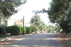
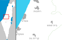
גיזו הוא כפר הממוקם צפונית-מערבית לבית שמש ושייך למועצה האזורית מטה יהודה.
היישוב הוקם בשנת 1960 על ידי הסוכנות היהודית בצמוד למושב צלפון, כמרכז אזורי של מועצה אזורית גיזו בו שכנו משרדי המועצה[3], בית הספר האזורי של המועצה ומספר בתים עבור מורים שלימדו בבית הספר[4]. בתחילה נקרא היישוב "מרכז צלפון", אך עם איחוד המועצות האזוריות להקמת מועצה אזורית מטה יהודה, שונה שמה ל"מרכז גיזו"[5].
הוא הוקם על אדמות הכפר הערבי בית ג'יז, שתושביו נמלטו ממנו במהלך מלחמת העצמאות ולא הורשו לחזור. האדמות הוכרזו נכסי נפקדים ועליהן הוקם היישוב.
כיום מתגוררות ביישוב כ-46 משפחות. בנוסף על כך, פועל במקום בית ספר יסודי ממלכתי-דתי[6].
מקור השם
נקרא על שם גִּזֹה, מקום הולדתם של בני הגִּזוֹנִי מגיבורי דוד (דברי הימים א יא, לד). שם המקום נשמר כפי הנראה בשמו של הכפר הנטוש בית ג'יז[7].
קישורים חיצוניים
- צפריר רינת, הטבע ניצח: היישוב גיזו לא יורחב, באתר הארץ, 5 באפריל 2007
הערות שוליים
- ^ 1 2 אוכלוסייה בעיריות, במועצות המקומיות והאזוריות וביישובים בעלי 2,000 תושבים לפחות - לפי טבלה חודשית של למ"ס עבור סוף דצמבר 2024 (אומדן), בכל יתר היישובים - לפי טבלה שנתית של למ"ס עבור סוף 2023.
- ^ הנתונים לפי טבלת מדד חברתי כלכלי של למ"ס נכון לשנת 2021
- ^ משרדי מועצת גיזו עוברים לצלפון, מעריב, 11 בספטמבר 1960
- ^ נ. אביאלי, נפתחה שנת הלימודים ביישובי פרוזדור ירושלים, חרות, 8 בספטמבר 1960
- ^ רשימת שמות יישובים, ילקוט הפרסומים 1143, 28 בדצמבר 1964, עמ' 899
- ^ גיזו, באתר www.m-yehuda.org.il
- ^ יואב רגב, מדריך ישראל החדש, כרך 10: השפלה, כתר, ידיעות אחרונות ומשרד הביטחון, 2001
| ||||||||||||||||


